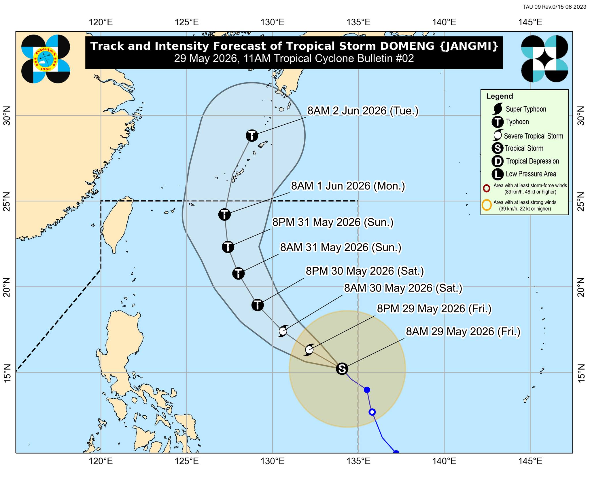
Tropical Storm “Domeng” may intensify into a typhoon on Saturday, May 30, while remaining over the Philippine Sea, state weather bureau PAGASA said.
In its 11 a.m. bulletin, PAGASA warned that heavy rainfall and severe winds may be experienced even in areas outside the forecast confidence cone as Domeng moves within the Philippine Area of Responsibility (PAR).
The weather bureau said Domeng will generally move northwestward until Sunday, May 31, before turning north-northwestward to northeastward.
PAGASA added that Domeng is unlikely to make landfall over the country and is expected to exit the PAR by Monday, June 1.
As of the 11 a.m. advisory, the tropical storm was located 1,265 kilometers east of Southeastern Luzon, packing maximum sustained winds of 85 km/h near the center and gusts of up to 105 km/h, while moving northwestward at 15 km/h.
PAGASA also warned that Domeng’s strong winds may extend up to 400 kilometers from the center.
While Domeng is less likely to directly affect the country’s weather within the next 24 hours, it may still bring heavy rains and strong winds over the western section of the country.
Based on the latest forecast track, PAGASA said the hoisting of tropical cyclone wind signals over Extreme Northern Luzon remains less likely, but is not ruled out. — Photo from PAGASA, (as of 11 a.m., 30 May 2026)