The Philippine Atmospheric, Geophysical and Astronomical Services Administration (PAGASA) has warned that Tropical Storm “Opong” is likely to strengthen into a typhoon within 48 hours and bring severe weather conditions to Metro Manila and Southern Luzon.
In a press conference on Wednesday, September 24, PAGASA weather forecaster Benison Estareja said Friday, September 26, will be a “crucial day” for residents in the capital region as Opong is expected to cross Metro Manila that afternoon.
“In Metro Manila, the main impact will be both strong winds and heavy rain. Based on the latest track, as early as Friday afternoon Metro Manila may already experience strong winds. A high wind signal is expected, Signal No. 3 or No. 4,” Estareja said.
He added that from Friday noon, September 26 to Saturday noon, September 27, rainfall could exceed 100 millimeters, raising the risk of widespread flooding and river overflows.
PAGASA Administrator Dr. Nathaniel Servando urged residents in Metro Manila and nearby provinces to take precautionary measures immediately.
“There is a strong directive to start preparing as early as possible for Tropical Storm Opong,” he said.
Servando warned that as Opong intensifies into a typhoon, it may trigger flooding, landslides, and possible storm surges in coastal areas.
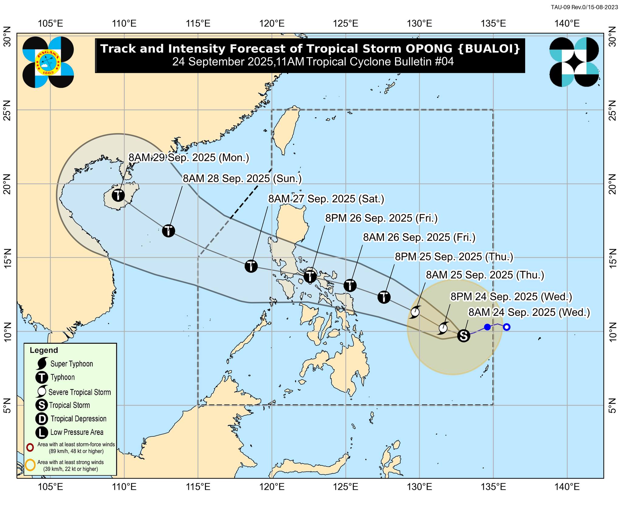
In its 11 a.m. bulletin, PAGASA said Opong was located 815 kilometers east of Northeastern Mindanao, with maximum sustained winds of 85 km/h, gusts of up to 105 km/h, and moving west-southwest at 15 km/h.
Tropical Cyclone Wind Signal No. 1 remains raised over Northern Samar, Eastern Samar, and Samar. PAGASA expects Opong to exit the Philippine Area of Responsibility (PAR) by Saturday evening, September 27, or Sunday, September 28.