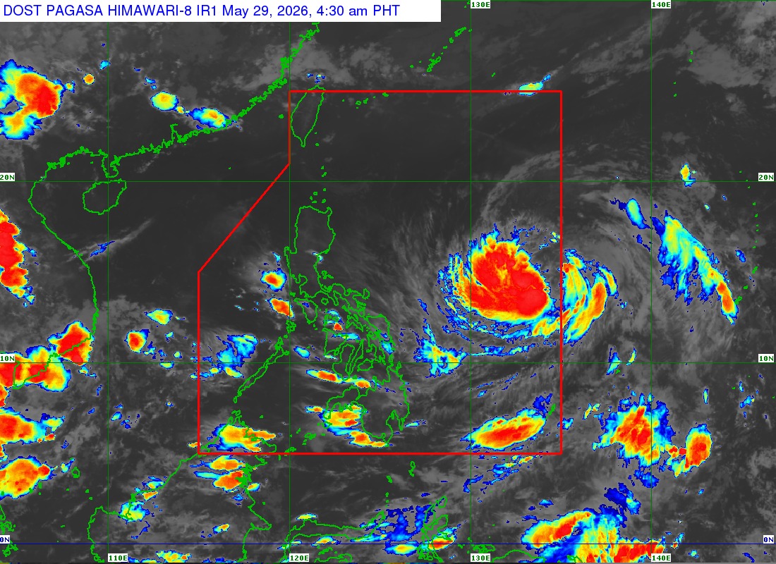
Tropical storm Domeng entered the Philippine Area of Responsibility on Friday midnight, PAGASA said.
In its 5 a.m. tropical cyclone bulletin, Domeng is located at 1,345 km east of Southeastern Luzon.
It has maximum sustained winds of 75 km/h near the centers, gustiness of up to 90 km/h and is moving northwestward at 20 km/h.
While Domeng has already entered the PAR, the weather bureau said it is less likely to affect the country’s weather condition in the next 24 hours.
However, Domeng may enhance the southwesterly windflow that may bring rains in the western part of the country in the weekend.
PAGASA warned of strong to gale-force gusts of wind in several provinces particularly in the coastal areas in the weekend.
For May 30, the following areas may experience strong winds:
• Most of Visayas
• Batanes
• Cagayan
• Pangasinan
• Zambales
• Bataan
• Cavite
• Batangas
• Occidental Mindoro
• Oriental Mindoro
• Romblon
• Marinduque
• Masbate
• Albay
• Sorsogon
• Palawan
• Zamboanga del Norte
• Misamis Oriental
• Camiguin
• Agusan del Norte
• Surigao del Norte
• Dinagat Islands
• Sarangani
• Davao Occidental
• Davao Oriental
PAGASA said the following areas may experience strong winds on Sunday, May 31:
- Most of Visayas
- Batanes
- Cagayan
- CALABARZON
- MIMAROPA
- Bicol Region
- Zamboanga del Norte
- Misamis Occidental
- Misamis Oriental
- Camiguin
- Agusan del Norte
- Dinagat Islands
- Surigao del Norte
- Sarangani
- Davao Occidental
- Davao Oriental
PAGASA said the next weather bulletin on tropical storm Domeng will be at 11 a.m. — Photo from PAGASA (as of 5 a.m., 29 May 2026)