The southwest monsoon or habagat is being enhanced by three tropical cyclones inside and outside the Philippine Area of Responsibility (PAR), PAGASA said.
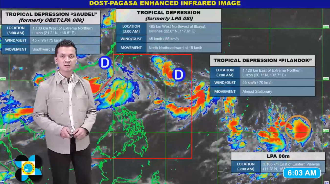
In its 5 a.m. advisory on Monday, August 31, PAGASA weather specialist Aldczar Aurelio said Tropical Depression “Pilandok,” currently inside the PAR, is expected to intensify into a tropical storm before weakening back into a tropical depression by Wednesday, September 2.
“Pilandok” is forecast to exit the PAR by Thursday, September 3, and is unlikely to make landfall in the Philippines.
As of the latest bulletin, the center of “Pilandok” was located 1,120 kilometers east of Extreme Northern Luzon, with maximum sustained winds of 55 kilometers per hour, gusts of up to 70 kph, and is nearly stationary.
Aurelio added that, aside from “Pilandok,” former Tropical Depression “Obet” and a newly formed tropical depression—both outside the PAR—are also enhancing the habagat.
As a result, the southwest monsoon will continue to bring rains over Luzon and the Visayas on Monday.
The center of “Obet” was last located 1,180 kilometers west of Extreme Northern Luzon, packing maximum sustained winds of 45 kph, gusts of up to 75 kph, and moving southward at 15 kph.
Meanwhile, the newly formed tropical depression outside the PAR was spotted 485 kilometers west-northwest of Itbayat, Batanes. It has maximum sustained winds of 45 kph, gusts of up to 55 kph, and is moving north-northeastward at 15 kph.
A low-pressure area (LPA) outside the PAR also has a medium chance of developing into a tropical depression. It was located 3,105 kilometers east of Eastern Visayas and is not expected to directly affect the country’s weather, Aurelio said.