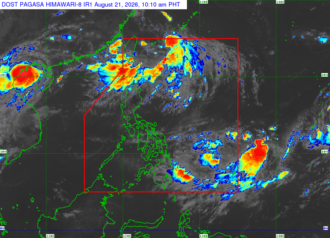
A severe tropical storm outside the Philippine Area of Responsibility (PAR), internationally named “Saudel,” is expected to enter the country’s monitoring area by Sunday or Monday, the Philippine Atmospheric, Geophysical and Astronomical Services Administration (PAGASA) said.
In its 10:00 a.m. weather update, PAGASA said “Saudel” was last located 2,680 kilometers east of Southeastern Luzon.
The storm has maximum sustained winds of 95 kilometers per hour, with gusts of up to 115 kph, and is moving west-northwestward at 10 kph.
PAGASA weather specialist Obet Badrina said in a Friday morning forecast that “Saudel” is expected to enhance the southwest monsoon, or habagat, which has slightly weakened.
Badrina said the habagat continues to affect most parts of the country but has weakened since Thursday, bringing generally fair weather conditions until Saturday.
However, the southwest monsoon is expected to strengthen again once “Saudel” enters the PAR on Sunday or Monday.
Once inside the PAR, the storm will be given the local name “Obet,” PAGASA said.
Meanwhile, PAGASA is also monitoring two low-pressure areas (LPAs) outside the PAR.
The northern LPA, formerly Tropical Depression “Neneng,” was last spotted 650 kilometers north-northeast of Itbayat, Batanes.
Although it has weakened into a remnant low, PAGASA said it has a medium chance of redeveloping into a tropical depression within the next 24 hours, but it is not expected to affect the country.
Another LPA located 1,495 kilometers east of northeastern Mindanao also has a medium chance of developing into a tropical depression.
However, PAGASA said this weather disturbance is expected to dissipate quickly and is unlikely to affect the country. — Photo from PAGASA