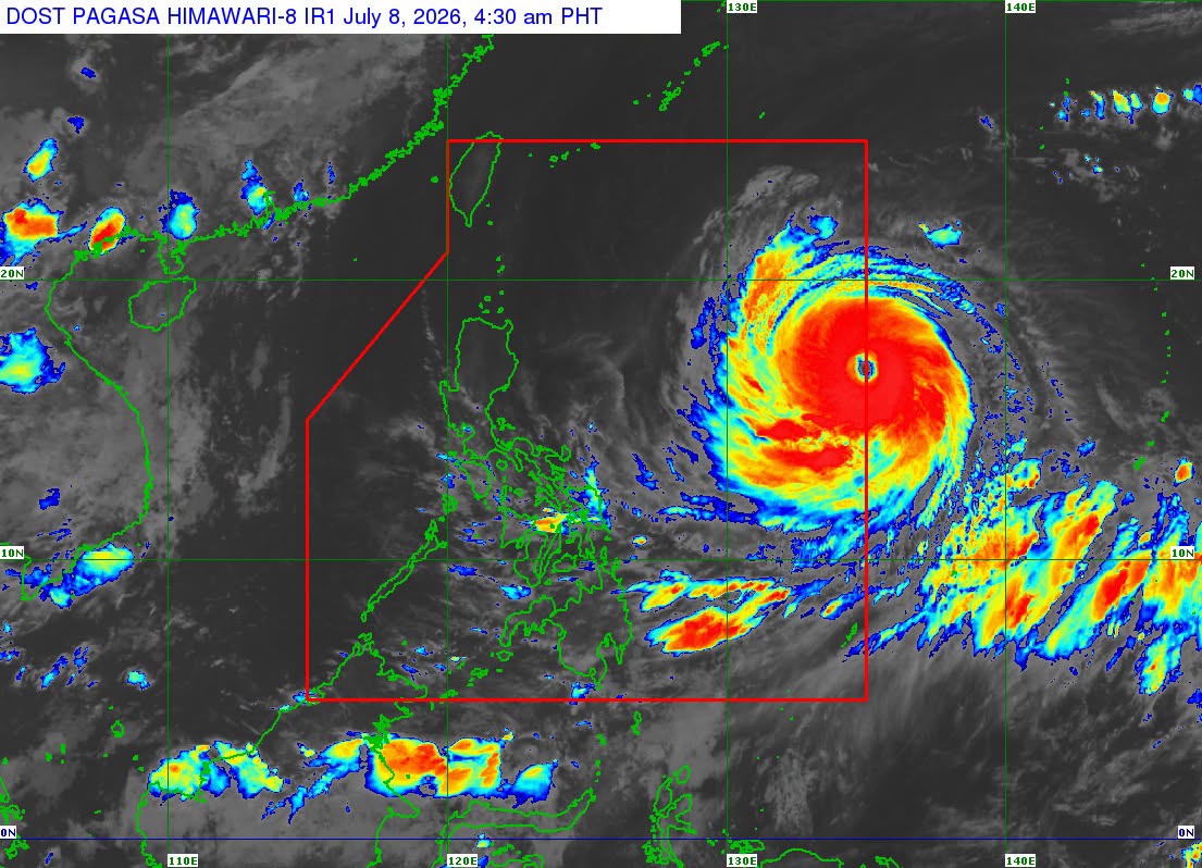
WEATHER ALERT: Tropical Cyclone Wind Signal No. 1 has been raised over more areas in Northern Luzon after Super Typhoon “Inday” entered the Philippine Area of Responsibility (PAR), state weather bureau PAGASA said.
In its 5 a.m. bulletin, PAGASA said the following areas are under Signal No. 1:
- Batanes
- Cagayan, including the Babuyan Islands
- Northern and central Isabela
- Apayao
- Eastern Kalinga
- Northern Aurora (Dilasag)
- Northern and central Catanduanes
The center of the eye of “Inday” was last located 1,405 kilometers east of Northern Luzon.
The super typhoon packs maximum sustained winds of 185 km/h near the center, with gusts of up to 230 km/h, and is moving westward at 25 km/h.
PAGASA said “Inday,” along with the enhanced southwest monsoon or habagat, will bring strong to gale-force gusts over Pangasinan, Zambales, Bataan, CALABARZON, most of MIMAROPA, the Bicol Region, and large parts of the Visayas and Mindanao.
Over the next 24 hours, the cyclone is forecast to move generally westward before turning northwestward while over the Philippine Sea.
“Inday” is expected to pass close to Extreme Northern Luzon by Friday, July 10, before heading toward southern Japan and the waters north of Taiwan.
The weather bureau added that the super typhoon may exit the PAR by Saturday, July 11, and could make landfall over eastern mainland China by Sunday, July 12.